⚠️ SEVERE THUNDERSTORM WATCH ISSUED FOR PARTS OF NEW JERSEY

⚠️ SEVERE THUNDERSTORM WATCH ISSUED FOR PARTS OF NEW JERSEY

NUNU WEATHER: Keep your phone nearby and make sure emergency weather alerts are turned on. A Severe Thunderstorm Warning means severe weather is occurring or imminent in the warned area and residents should seek shelter immediatel

AdminAugust 10, 2026

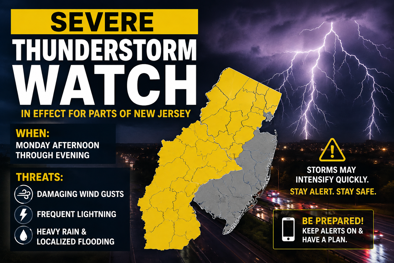
NEW JERSEY — Residents are being urged to keep an eye on the weather Monday afternoon and evening as strong to severe thunderstorms threaten portions of the Garden State.

The National Weather Service has issued a Severe Thunderstorm Watch, with forecasters warning that storms developing later today could become severe. The main threats include damaging wind gusts, frequent lightning and torrential downpours, with localized flooding also possible.

The National Weather Service says the risk for severe thunderstorms is increasing this afternoon and evening. Temperatures are also soaring into the 90s in parts of the state, adding fuel to an unstable atmosphere.

Storms are expected to develop and move through the region during the afternoon and evening hours. Not every community will necessarily see severe weather, but any stronger storm could intensify quickly.

Residents should secure loose outdoor items, use caution while driving during heavy rain and remain indoors when thunder is heard.
Comments

No comments yet. Be the first!

Related Articles

BREAKING:*TORNADO WARNING AND SEVERE STORMS GRIP THE MIDWEST- CHICAGO
Weather Shorts

BREAKING:*TORNADO WARNING AND SEVERE STORMS GRIP THE MIDWEST- CHICAGO

A dangerous line of storms is moving across the Midwest, bringing tornado warnings, embedded rotation, and damaging winds impacting the Chicago area. Severe thunderstorm warnings are in effect, with wind gusts reaching up to 100 MPH and stronger winds near 130 MPH detected just above the surface. The storm system, which formed over eastern Iowa earlier today, is rapidly pushing southeast toward Indiana and Ohio and may evolve into a derecho as it continues to intensify.

Aug 11
WEATHER TUESDAY 7/21:     SEVERE STORMS TARGET TRI-STATE; DAMAGING WINDS, TORNADOES POSSIBLE
Weather Shorts

WEATHER TUESDAY 7/21: SEVERE STORMS TARGET TRI-STATE; DAMAGING WINDS, TORNADOES POSSIBLE

SEVERE WEATHER RETURNS TO THE TRI-STATE Here we go again! Another batch of strong and severe storms will target the region today An active weather pattern is setting up for Tuesday as a cold front approaches and a warm, humid air mass surges into the area. Dew points in the upper 60s to low 70s will fuel moderate to strong instability, while strong winds aloft will provide plenty of wind shear for organized severe thunderstorms. Main Takeaways:🌩️ A widespread severe weather threat is expected Tuesday into Tuesday evening. 💨 Damaging winds are the primary concern, with the potential for wind gusts over 65 mph. 🌪️ A few tornadoes are possible if discrete supercell thunderstorms develop (esp west of NYC) 🧊 Large hail is possible, but the threat appears more limited due to relatively warm air aloft. ⚡ Storms could evolve into a mix of supercells and bowing lines of thunderstorms, though the exact storm mode remains uncertain.

Jul 20