Weather Shorts News

25 articles

BREAKING:*TORNADO WARNING AND SEVERE STORMS GRIP THE MIDWEST- CHICAGO
Weather Shorts

BREAKING:*TORNADO WARNING AND SEVERE STORMS GRIP THE MIDWEST- CHICAGO

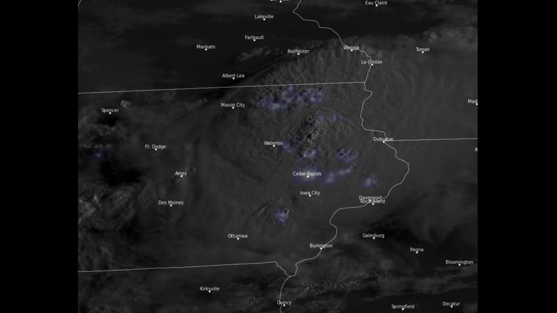
A dangerous line of storms is moving across the Midwest, bringing tornado warnings, embedded rotation, and damaging winds impacting the Chicago area. Severe thunderstorm warnings are in effect, with wind gusts reaching up to 100 MPH and stronger winds near 130 MPH detected just above the surface. The storm system, which formed over eastern Iowa earlier today, is rapidly pushing southeast toward Indiana and Ohio and may evolve into a derecho as it continues to intensify.

Aug 11
WEATHER TUESDAY 7/21:     SEVERE STORMS TARGET TRI-STATE; DAMAGING WINDS, TORNADOES POSSIBLE
Weather Shorts

WEATHER TUESDAY 7/21: SEVERE STORMS TARGET TRI-STATE; DAMAGING WINDS, TORNADOES POSSIBLE

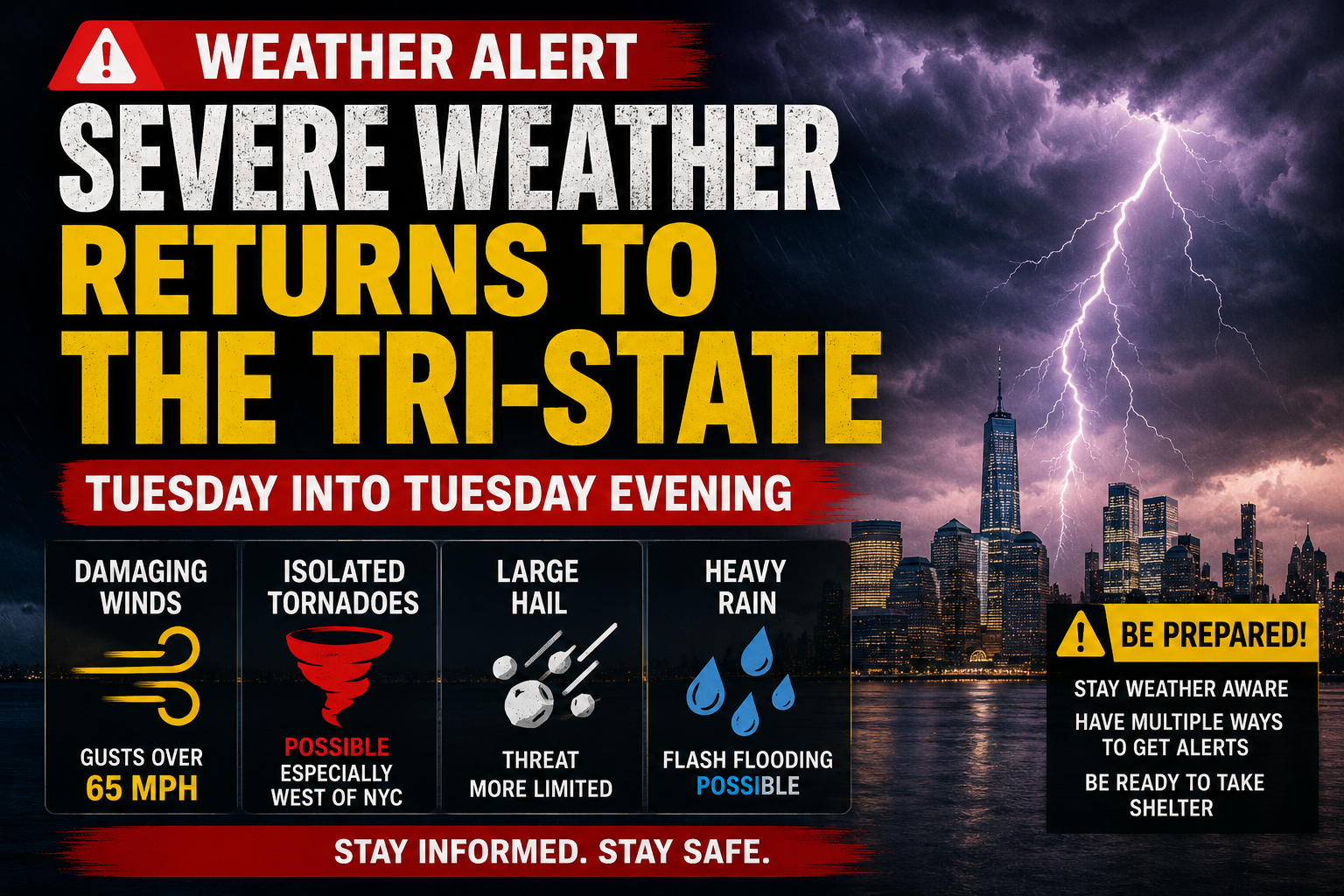
SEVERE WEATHER RETURNS TO THE TRI-STATE Here we go again! Another batch of strong and severe storms will target the region today An active weather pattern is setting up for Tuesday as a cold front approaches and a warm, humid air mass surges into the area. Dew points in the upper 60s to low 70s will fuel moderate to strong instability, while strong winds aloft will provide plenty of wind shear for organized severe thunderstorms. Main Takeaways:🌩️ A widespread severe weather threat is expected Tuesday into Tuesday evening. 💨 Damaging winds are the primary concern, with the potential for wind gusts over 65 mph. 🌪️ A few tornadoes are possible if discrete supercell thunderstorms develop (esp west of NYC) 🧊 Large hail is possible, but the threat appears more limited due to relatively warm air aloft. ⚡ Storms could evolve into a mix of supercells and bowing lines of thunderstorms, though the exact storm mode remains uncertain.

Jul 20
BREAKING:Flash Flood Emergency-Dangerous Flooding Underway
Weather Shorts

BREAKING:Flash Flood Emergency-Dangerous Flooding Underway

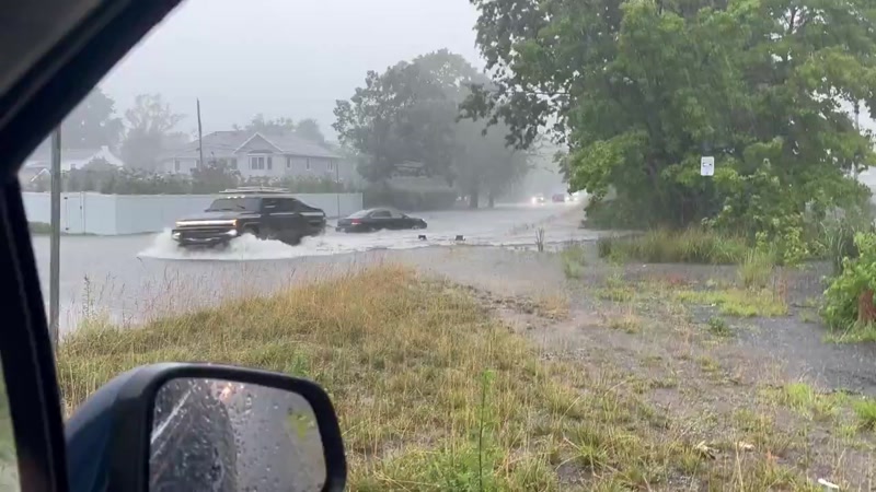
Heavy rain has created dangerous flooding in many areas. Residents are urged to avoid unnecessary travel and never drive through flooded roads. It only takes a small amount of moving water to sweep a vehicle away, and it is often impossible to tell how deep the water is. If you are at home, stay informed by monitoring local weather alerts and emergency notifications. Move to higher ground if flooding threatens your area, and avoid walking through floodwaters, which may contain debris, sewage, or hidden hazards. Keep flashlights, charged phones, medications, drinking water, and other emergency supplies readily available in case of power outages. If you encounter a flooded roadway, turn around and find another route. Stay away from fast-moving streams, storm drains, and downed power lines, and report emergencies to local authorities. Your safety is the top priority—do not take unnecessary risks until conditions improve. Video below is deal New Jersey

Jul 6
BREAKING: MASSIVE STORMS LEAVE THOUSANDS WITHOUT POWER AS EXTREME STORMS HIT LAKEWOOD
Weather Shorts

BREAKING: MASSIVE STORMS LEAVE THOUSANDS WITHOUT POWER AS EXTREME STORMS HIT LAKEWOOD

As Shabbos began, powerful storms swept through the Lakewood area, knocking out electricity to thousands of residents. Many neighborhoods, including Raintree, were plunged into darkness, with some families remaining without power for nearly 24 hours. With temperatures hovering around 100 degrees, the outages created extremely difficult conditions. Many homes were left without air conditioning, and countless families lost refrigerated and frozen food as the blackout continued. After Shabbos ended, even more power outages were reported, leaving additional residents in the dark. While electricity has been restored to many customers, others are still waiting for their power to return. Another round of storms is now moving through Lakewood and is expected to head toward Brooklyn, raising concerns that additional outages could occur. JCP&L crews have been working around the clock to restore power as quickly and safely as possible.

Jul 5